Showing posts with label hiking. Show all posts

Thursday, January 23, 2020

Why Rodeo?


Rodeo is a small town burg along NM Hwy 80 in southwestern New Mexico, with a population of 101 (at the 2010 census.)   Exploring on foot,


ABN was pleased to find a nice little co-op art gallery


showcasing very talented artists in a variety of mediums.


Down the street road a piece we found


Beer Collection


which Captain found more interesting than ABN. 

That plus a grocery, post office, and a swap and shop was about all we found in the town of Rodeo. So why were we here?

It was the surrounding area that captivated us.

We parked The Wanderer at Rusty’s RV Ranch


about 10 miles north of Rodeo in a high valley surrounded by mountains. There are no commercial establishments to be seen for miles; no billboards, no traffic signals, no restaurants, no big box stores, no artificial lights. Just wide open space with a big sky. And that, friends, is what brought us to Rodeo and Rusty’s. A magnet for astronomers, Captain wanted to see the stars clearly. Rusty’s is a dark sky campground which means outside lights are forbidden and windows must be covered at night. Captain got his wish.

You can see the Milky Way above The Wanderer.
The Chiricahua Mountains gave us a great place to hike.

Cathedral  Vista
Sharing the trail with about half a dozen locals.
On the Silver Peak Trail (those of you that have hiked the trail, the answer is "no"  we did not hike to the peak as that would be well beyond our current level of fitness.)

We have not had any more trouble from The Wanderer but are keeping our fingers crossed.

The weekend will find us boondocking at Copper Hop Ranch in Elgin, Arizona.

Note to email subscribers, hitting reply to the email notification of a new post will send your reply out somewhere in cyber space and we will never know of your comments.  If you wish to comment, please do so in the comment section on the blog site or send a note using the email address you have in your contact list. 


Monday, January 28, 2019

Moving on Down the Road

This past week our home has been in Catalina State Park, just north of Tucson in Oro Valley, AZ. Located at the base of the Catalina Mountains it has become a favorite place to park The Wanderer. Undoubtedly, the restrooms/shower houses are the cleanest of any park where we have stayed; the campground hosts are very friendly and helpful; it is convenient to the Oro Valley/Tucson extensive bike paths as well as many hiking trails. 

The moderate to difficult Romero Pools Trail is located in the park.


The Pima Canyon Trail is not far.


The public access right of way goes past some very beautiful homes. (Bet the parties here serve very good wine and food!)
Captain on the trail
There are so many more trails yet to explore.

We love that we can get on the 100 + mile shared-use path, The Loop,  just outside the entrance to the park. 


And go just about anywhere in Oro Valley and Tucson. 

This trip we parked in the Ring Tail Loop, without the convenience of electricity, water or sewage. We were pleased with the solar panels, only running the generator for an hour or so each day (that was more of a prophylactic measure than a necessity,) It was a bit chilly in the early mornings with temperatures in the high 20s/low 30s, but by 10:00 a.m. it was an enjoyable 50s/60s. 

Our Colorado friends, Adele and Steve, were parked in Campground A.


As always, it was great fun to share meals, stories, RV upgrades and, of course, good wine.

Meritaggio  from David Arthur Vineyards 

Adele took this photos of the hummingbirds feeding at our window. 

Last, but certainly not least, another favorite reason to visit in Oro Valley is connecting with Cousin Lin and her husband Fred. They love showing us around the area they love so much. This time it was Mt. Lemon, a popular ski area.


Today we moved on down the road toward the border with high expectations of enjoying some authentic Mexican food. 

Note to email subscribers, hitting reply to the email notification of a new post will send your reply out somewhere in cyber space and we will never know of your comments.  If you wish to comment, please do so in the comment section on the blog site or send a note using the email address you have in your contact list. 


Monday, January 21, 2019

City of Rocks


Gale force winds (Is 30+ mph winds gale force?) greeted us when we entered New Mexico on Friday afternoon. Certainly too windy to enjoy the outdoors, so we parked The Wanderer at City of Rocks State Park and headed to St. Clair Winery to sip some wine and listen to a local band. The Cab-Zin made us think of home; we left with some nice port.

It seemed like a good idea to nestle The Wanderer in the rock formation, however Captain realized she would not be taking full advantage of the sun (which we needed to provide our electricity) so he scooted her out a little bit. It was really a cool campsite.
Saturday we woke to a nice, calm day with a brilliant blue sky. After ABN’s yoga session

we conquered Table Top Mountain

for a moderate 4-mile hike.

This is City of Rocks from the top of Table Top Mountain;

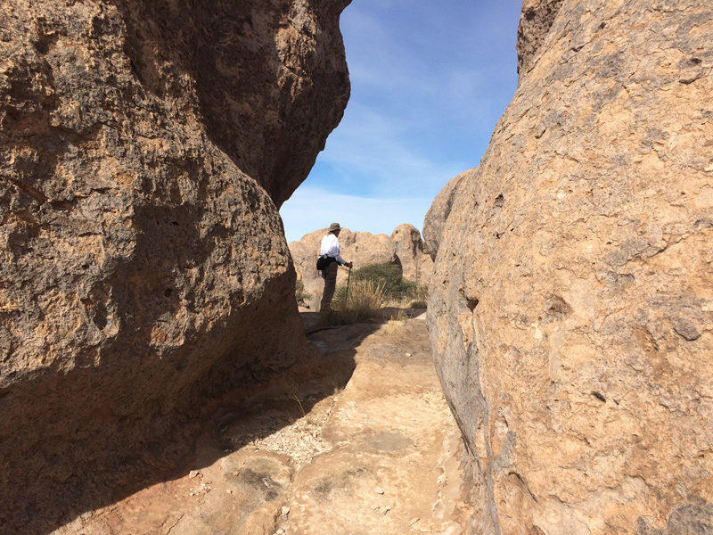
Sunday brought us another beautiful day. We hiked to the Observation Point

and explored the “city.”


It is estimated City of Rocks was formed from a volcanic eruption about 34.9 million years ago. It is a small, quiet state park located between Deming and Silver City in New Mexico. We found it to be wonderfully relaxing after spending the past month with family and friends. Now, if you know us or read our blog, you know the people with whom we connect as we travel are a large part of what feeds our souls; but sometimes solitude is nice.

Whether with friends or alone, at the end of the day it is all about serenity.

 Note to email subscribers, hitting reply to the email notification of a new post will send your reply out somewhere in cyber space and we will never know of your comments.  If you wish to comment, please do so in the comment section on the blog site or send a note using the email address you have in your contact list. 

Wednesday, October 10, 2018

Hiking Utah…..Part 4


This is how we saw Arches National Park on Sunday and Monday.


We drove through the park, stopping at various viewpoints. If it wasn’t raining too hard, we Captain got out to take photos.
Balanced Rock
Sometimes he took them from the car.

We were all happy to see the sun on Tuesday and headed to Devil’s Garden Trail, just outside the campground.


Pine Tree Arch
Landscape Arch


That was so much fun, we decided to hike the Broken Arch Trail from our campground. Now this is what you call an adventure hike!

Sometimes you had to climb,
Sometimes you had to slide,

Sometimes you had to crawl,

Sometimes you had to rest,

Sometimes all you could do is just say "Wow!"
Tapestry Arch

We were camped at Devils Garden Campground; if you look closely you can see The Wanderer.

There were no amenities like water, electricity or sewer but we did have a pretty decent cell phone signal. With solar and generator power we were able to watch the Aggies hand Kentucky their first defeat of the season on Saturday (now we are ready to talk football again.)

There are over 2000 arches in the park; of course we didn’t see them all. We are sharing only a few from our two hikes; here is a link if you want to see more. 

Today we are moving over to Dead Horse Point State Park, near Canyonlands National Park where we will conclude our hiking adventures in Utah.


Note to email subscribers, hitting reply to the email notification of a new post will send your reply out somewhere in cyber space and we will never know of your comments.  If you wish to comment, please do so in the comment section on the blog site or send a note using the email address you have in your contact list.


Monday, October 1, 2018

Hiking Utah….Part 2


Bryce Canyon, home of the Hoodoos.


Hiking at 7000 ft. – 8000 ft. has its challenges for those of us who live at about 400 ft. elevation; mostly our heart rates increase and our breathing gets a bit labored on the ascending climbs.

But it is worth it to hike between the canyon walls,

among the hoodoos and through the arches.

After arriving around noon on Friday, we took the guide book’s recommendation and drove to the various viewpoints.

Max got to come along for the ride.
He is such a sweet and well-mannered travel companion, we totally enjoy his company.

Our long and most challenging hike was about 4.5 miles. It included the Under the Rim Trail,

the Peek-a-Boo Trail (adequately named,)
Wall of Windows

and a part of the Navajo Trail.

Monday morning weather forecast indicated there could be some rain showers, so we elected to hike the 1.8 mile Queen’s Garden Trail and part of the Rim Trail. (It didn’t rain at all Monday morning.)


We ended our stay at Bryce Canyon with a celebratory dinner at The Lodge.
Photo

Not wanting to overwhelm with the hundreds of photos we took, these are a few of our favorites. If you want more, here is a link to images of Bryce Canyon National Park.

Today we will wander along the Scenic Byway, Utah 12 to Capitol Reef National Park. With lots of climbs it will be slow drive but we think The Wanderer can handle it. About the scenic, well maybe not so much, as once again rain is predicted.

Note to email subscribers, hitting reply to the email notification of a new post will send your reply out somewhere in cyber space and we will never know of your comments.  If you wish to comment, please do so in the comment section on the blog site or send a note using the email address you have in your contact list.